Being a site engineer always gets you involved with earthwork calculations. If you have a pc and a total station, things can be done easily and with high precision. The programs I use are AutoCAD Civil 3D (or Anadelta Tessera, I prefer Anadelta because of its better looking outcome), AutoCAD (if not using Civil 3D, for final retouching) and ofcourse Microsoft Excel.
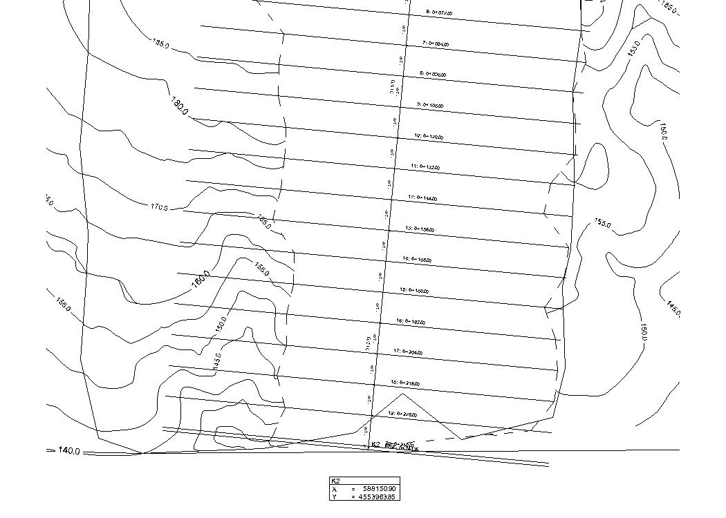
Here is the whole map, (made with anadelta). It contains the previous terrain, the place where earthworks had been done, the cross sections etc.
(and all the map in pdf format Test_1b-Model )
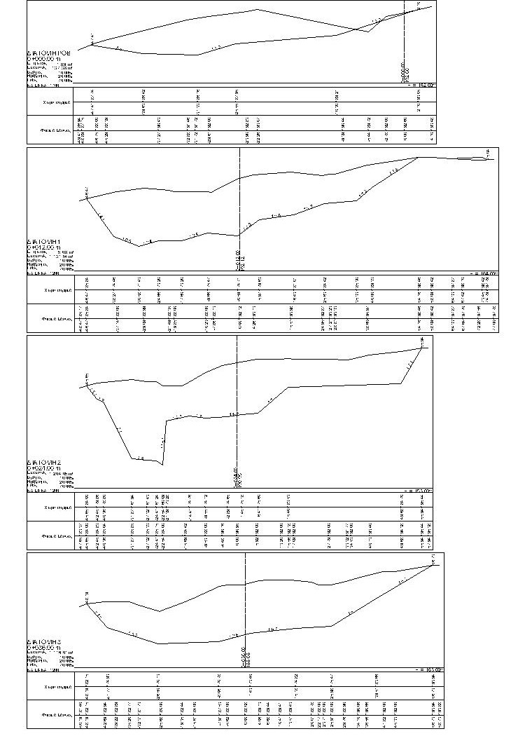
The cross-sections(sample):
(the sample in pdf format Test_1B_Diatomes-Model )
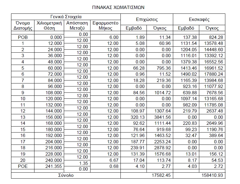
And at the end the earthwork calculation table:


